
My KoreAves article was published by One Earth
One Earth published Mapping South Korea’s birdlife, one observation at a time on October 28, 2026. The original page credits Jihun Oh as a contributor and identifies him as the creator of KoreAves. The publication describes the independent bird atlas I developed and explains how a reader can inspect its supporting evidence.
The publisher-hosted article is an external place to inspect the design and reasoning behind the project. I built KoreAves so that someone unfamiliar with South Korea’s bird references could move from a name to regional observation evidence and the records behind it. The difficult part was deciding how much a source actually justified showing on a map.
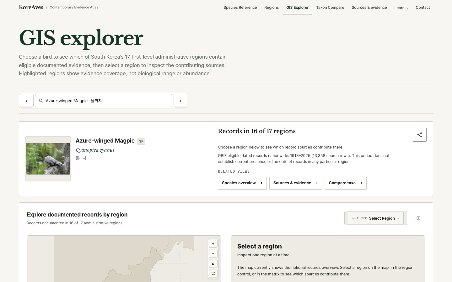
What I built and why the source trail matters
KoreAves organizes 597 species and 20 subspecies, or 617 taxonomic entries, following the reference checklist used for the project. I do not label those as 617 separate species. The atlas offers an English-first interface with Korean support, species references and a GIS explorer for documented evidence across South Korea’s 17 first-level administrative regions.
A shaded administrative region means the currently eligible source material includes a relevant record there. It cannot, on its own, establish how many birds live in the region, their precise range or whether the species will be present on a future visit. The project keeps taxonomic identity, dated observation records and eligibility for a regional display as separate questions.
That distinction shaped the interface. Visitors can investigate a regional view, return to the related records, and read the project methodology when a map needs explaining. Someone using the atlas for birding or education should be able to question the result without having to accept a coloured region on trust.
Writing it for an international environmental publication
The One Earth article presents that design to readers interested in biodiversity, travel and environmental information. It introduces the atlas through South Korean birds and asks readers to look at the evidence behind a regional map.
Preparing an explanation for that audience exercised a skill I use in software development: making data provenance and the limits of an interface legible to people who did not build it. That matters when a product crosses languages and source systems. A reader can now encounter the bylined article, open KoreAves, and examine the underlying source notes for themselves.
For an educator, this offers a concrete example of how records, names and maps interact. For a potential collaborator, it is a public account of the choices behind an accessible biodiversity tool. I can demonstrate that the project and its methods are understandable outside its original developer documentation.
The article is a contributor-published explanation hosted by One Earth. Its presence confirms the external publication and author credit. It does not establish an institutional partnership, independent product evaluation or adoption by schools. Any audience or referral outcome would need separate measurement.
The original article and author credit are the primary evidence. The public portfolio archive records the contribution, and my KoreAves technical overview shows how the evidence atlas works. A later Unsustainable Magazine contribution examines the specific problem of reading observation maps as population counts.