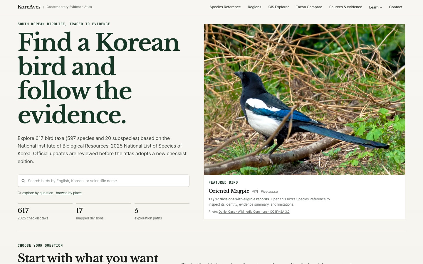
An independent project can be available on the web for months without being particularly discoverable. One useful indication of progress is when someone else’s resource index provides a way to find it. That has happened for KoreAves, the bird evidence atlas I have been developing for South Korea.
This is a record of what I can actually verify—not a claim of institutional partnership, scientific approval or measurable traffic growth.
The project behind the links
KoreAves connects species and subspecies identities, regional occurrence evidence, source provenance, and images that can be reused responsibly. The aim is to help readers understand where bird records come from and what they do not prove. A recorded occurrence is not a population estimate; an administrative region with qualifying evidence is not a biological range polygon.
The atlas covers a reference of 597 species and 20 subspecies, 617 taxa in total. The underlying documentation is public through the dataset notes and methodology.
Where the project appears
Ten public source pages link readers to KoreAves, with different audiences and publication status:
- Beary Birding includes KoreAves under Online Field Guides, alongside other bird-reference tools. This is an external resource listing, not a review or formal endorsement.
- Wetland Link International (WLI) — Migratory birds (wli-migratory-birds-koreaves): The resource page describes KoreAves as a way to explore Korean bird records in English while keeping the underlying evidence visible. It links directly to the original atlas. This is a public resource link, not WLI membership, a partnership, endorsement or measured use.
- New Zealand Birds links to the project on its birding links page and labels it a Korean bird evidence atlas.
- FMHY Educational Wiki includes KoreAves in its biology learning resources. This is a community-maintained directory entry.
- Kartoza Awesome Geodata links to KoreAves in its South Korea section. The public README describes a free bird occurrence-evidence atlas with regional GIS views and source links. Its geodata focus gives GIS readers a different way to encounter the atlas. The listing does not document a formal endorsement or measured use.
- Fat Birder — Republic of Korea birding guide (fatbirder-koreaves-republic-of-korea) lists and links KoreAves under Organisations. The original listing date, any formal partnership and resulting traffic are not established by this link.
-
Nav-AI has a public KoreAves software-directory entry with a direct link to the live atlas. Its overview draws on the project’s published homepage. It does not establish independently tested functionality, user reviews, or adoption.
- Bird Album — South Korea (birdalbum-koreaves-further-reading) includes KoreAves as a Further reading link to the live atlas. I checked that same link in four public editions: English, Korean, Japanese and French. This is one inclusion presented in several languages, not four separate endorsements.
- GREENUS Resources & Tools (greenus-koreaves-community-tool) lists KoreAves as a Mapping Tool created independently by Jihun Oh, under its Learning pillar. The entry suggests using documented bird records to discuss what a coloured region means, where the evidence comes from and what gaps cannot tell us. That is a publicly visible resource listing, not evidence of a partnership or measured classroom use. Its Open Tool button currently points to the old
/explorer/path (HTTP 404); the working KoreAves GIS explorer and methodology provide a direct route to the actual tool. - Kantorilode’s Birds of Japan links (kantorilode-koreaves-legacy-links) now include a SOUTH KOREAN BIRDING link directly to KoreAves on the primary domain and the web.app page. Both were verified on November 15, 2026. The older Weebly directory still labels the entry KOREAVES (South Korean bird database). This corrects my earlier statement that the primary domain had no link. The three addresses are one resource directory, not separate endorsements or proof of visits.
The lists serve different readers. GREENUS places the map in an environmental data-literacy context. The relevant engineering work was to connect each regional display to the evidence that supports it. An educator can use that connection to ask why a recorded occurrence is not a population estimate and why an uncoloured region does not prove absence. I have not measured actual use of the tool in classrooms.
Bird Album’s country reference offers a bird-information route alongside the older software and geodata directories. Bird Album’s data-source explanation uses IOC World Bird List 15.2, while the KoreAves dataset notes describe a Korean national checklist foundation. A link between the projects does not make their taxon concepts identical. None of these listings measures actual reader visits to KoreAves.
Fact-checking the map explanation in a Suncheon Bay guide
Daily Korea’s Suncheon Bay birdwatching guide (currently dated November 19, 2026 by the publisher) links to the KoreAves regional evidence map and guide to reading occurrence records while discussing how to look for Hooded Cranes. It explains that a shaded region indicates qualifying records, not a population count.
I suggested a beginner’s guide to Suncheon Bay and reviewed the Korean draft, sending corrected wording for the KoreAves map explanation. The editors revised the section to explain that a shaded administrative region has qualifying bird records. The shading does not predict current sightings inside the wetland or represent a population count. The editorial team separately checked winter admission hours and the station-departure tour against the operator’s current booking information. The published page is credited to Daily Korea Editorial. My contribution was a fact-check of the map interpretation; I have no author or co-author credit. Visits from the article to KoreAves have not been measured.
A separate kind of record: GBIF Literature
The GBIF Literature API record identifies KoreAves as a WEB_PAGE, with the project website as the linked resource. This is a catalogue/data-use record. It should not be read as a peer-reviewed publication, a quality certification, or an institutional endorsement by GBIF.
That distinction matters because the words indexed, listed, published and partnered are not interchangeable.
What this changes—and what it does not
These public listings give the project additional discovery paths. They also reinforce a practical design choice: source attribution and limitations are part of the product, not merely footnotes.
What I cannot infer from the listings alone is audience size, adoption, institutional approval or scientific validation. Those would require other evidence. I will keep recording external references with a link to the original page and an exact description of the relationship.
Next steps
The most valuable work is still the difficult work: better source coverage, taxon alignment, more rights-cleared imagery and clearer explanations of the atlas’s limits. External links are encouraging because they connect those efforts to actual discovery—not because they finish the work.
For the full engineering context, see the KoreAves case study and the original technical introduction.